
Posted by geemiz | Posted in Bohol, Byahe Pilipinas | Posted on 22-02-2016
Tags: Travel Blog, Travel Blogger
I love the outdoors and especially nature. I like both mountains and sea but I have a special connection with trees and mountains. I love the peacefulness it brings and the feeling of life in it.
I go to nature to be soothed and healed and to have my senses put in order. – John Burroughs
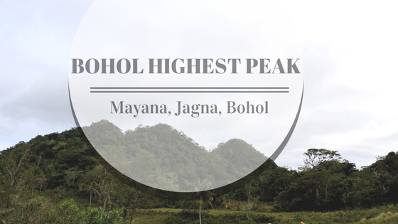
I am not a professional mountain climber but the past months it has been filled with trekking and mountain adventures. This time I discovered that the highest peak in Bohol is not one of the chocolate hills but is a peak located in my hometown Jagna. Together with friends, we climb Bohol’s highest Peak the Mayana Peak
Mayana, Jagna, Bohol
Mayana is one of the baranggay of Jagna, Bohol. A third-class municipality in the east side of Bohol an hour away from Tagbilaran City and the portal of Central Visayas to Mindanao.
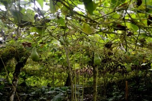
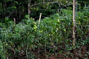
Mayana is called the Little Baguio of Bohol due to its cold weather. The barangay itself is 820m above sea level. Mayana is a land rich in flowers, fruits, and vegetables.
How to go to Mayana
Jeepney – From Jagna public market there is a jeepney going to Mayana but it only has 1 schedule which is during afternoon.
Habal-habal – The easiest transport to Mayana is by habal-habal. Fair is 100 pesos one way per habalhabal.
Mt. Matunog – Highest Peak in Bohol
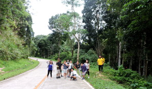
The trekking to Mayana Peak is an adventure. In my opinion, it is livelier than the trek to Osmena Peak (Read post about Osmena Peak).
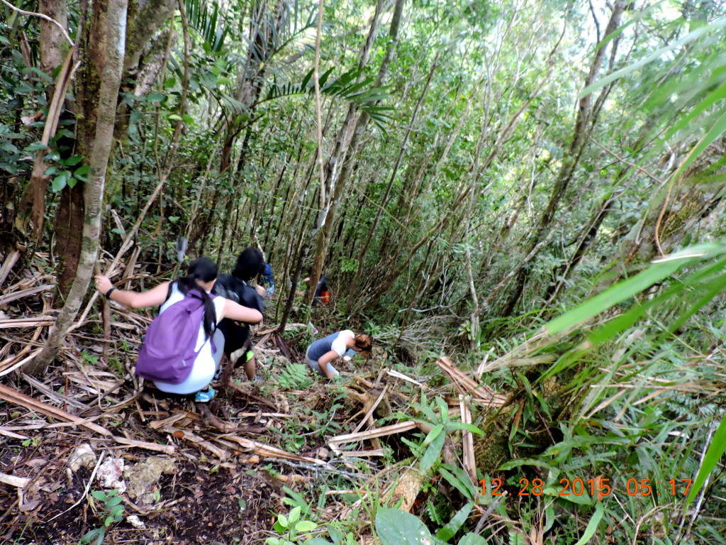
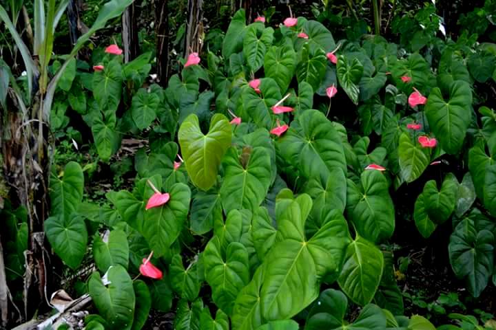
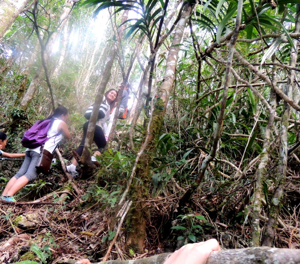
Going to the peak, you need to pass a mini forest, wildflowers, and 2 mountains. I feel enchanted walking under the shade of trees and passing through beautiful anthurium flowers. The 45-minute ascend and descend increase adrenaline levels.
The most daring part is ascending to the final peak. The path is really steep and all you have is to trust the small tree branches and grasses that serve as rails.
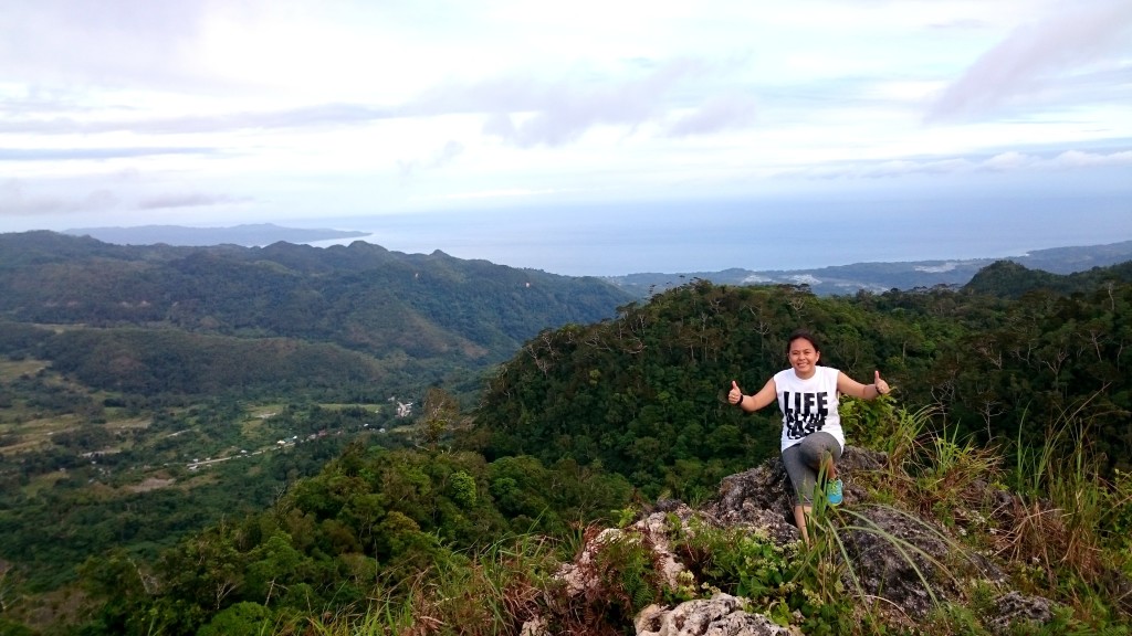
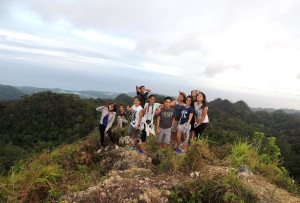
Reaching the top is so worth it as always. Seeing the vast see and the nearby mountain ranges of Garcia, Duero, Candijay and to the east most part of Bohol makes me want to jump of joy. Those places are so near up here and beautiful.
Other Attractions in Mayana
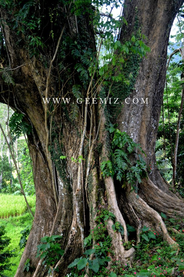
Centennial Tree
A narra species is estimated to be 100 feet high. It is the most giant national tree (Narra tree) in the Philippines.
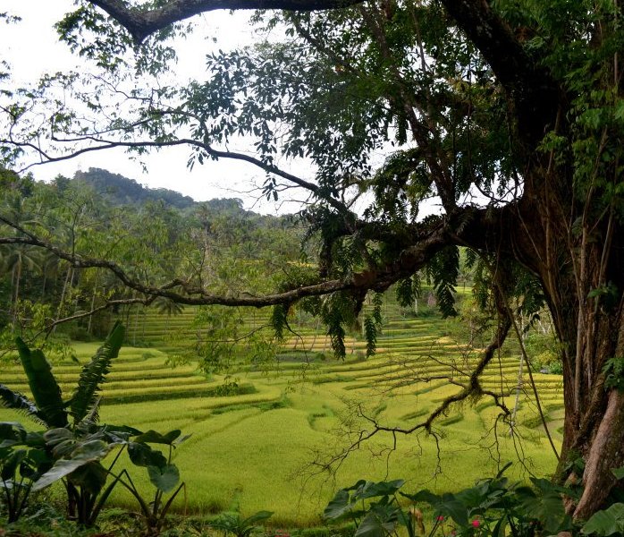
Rice Terraces
The rice terraces are scattered in the barangay of Mayana and Boctol having the latter most prominent terraces looking. The rice terraces occupy a total area of fifty (50) hectares.
The trip would not be complete without the squad. 🙂
Contact Information:
Jagna Tourism care of Ma’am Gina Ranan 09291334514. Tell her that G-zell of geemiz.com says hi. 🙂
I would love to hear from you. Connect with GeeMiz
Like Geemiz in facebook | Circle geemiz in Google Plus | Follow @geemiz in twitter | Follow Geemiz Instagram |Subscribe Geemiz Youtube

Hi. May I just ask if you were required a permit by the local telco companies to get to the peak? Other bloggers say they weren’t allowed to the peak because the security staff (of Globe and Smart) barred them, claiming the area is a private property.
Hi Jhuriz
The highest peak is not the mountain with the telco towers.
It is a different mountain before the telco towers.
Hi! Any details about getting a guide for the trek and payments required? Thanks!
Hello i want to ask did you leave some ribbons as a guide marker in a trail?? Im from loboc but i dont know that place .now im here in hk…where planning to climb there this coming dec 2016.
Hi Joy
No we did not leave any marker for the trail.
Thank you for this beautiful idea. I will suggest a marker to the tourism office of Jagna.
Hi Geemiz,
This must be the most informative article on the net regarding Mt. Mayana.
I was searching it just a few weeks ago, then flew low over it on the way back into Tagbi. It’s quite distinctive and recognizable in your photo.
Surely it would be a worthwhile tourist attraction…
Thanks a lot, happy travelling!
Thank you so much Ian. I am grateful to be of help.
I’d like to know, how high is Mayana Peak, and how long is this range, if I’m gonna traverse this? I’m planning to go Bohol on the 4th Friday of March 2018.
Thanks for your reply.
Hi, As of now I have no data on the highest point of the peak but just the barangay itself which is 820m above sea level. I will climb the mountain again this year and will bring a GPS. I will update the article as soon as I have the data.
Hi! Is it required to contact the Jagna tourism office first before trekking?
Hi Maria, It is not necessary but highly encouraged so that they can assist you on your climb to Mayana Peak.
I don’t see pine trees in your pictures. Is there any at all at this altitude? The scents of fresh pines is so refreshing.
Hi Felix, For sure there are pine trees in Mayana but no pine trees in the peak itself.
Hi. Is it okay to camp at the top? Is there a spot where we can build or tents up?
Hi Claire, not advisable to camp at the top since it has a little space.
Hi! I’m planning to climb Mt. Matunog/Mayana Peak on afternoon of 23 August 2019. Have already spoken with Ms. Gina Ranan, thanks to your blog. Anyone who wants to join, pm me on FB. 🙂
Hi Noel, Please let us know how was your climb?
pila ka hours padung sa peak maam?
Hi Julian
From the drop off point to the Peak is just roughly 3km with a slow steep ascent and limestone trail under a mini forest.
It really depends on your pace and weather. If the trail is wet then add a minimum of 20 minutes to the time.
Rough estimate:
newbie – 1.5 hours
intermediate – 1 hour
active trekker – 45 minutes